- 0:35 h
- 4.79 km
- 481 m
- 2,077 m
- 2,558 m
- 481 m
- Start: Furggelti mountain station
- Destination: Fleschen middle station
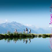
The trail starts at the highest point of the bike park at 2562 metres above sea level and has been designed to make the most of the views and panorama. Numerous creative features such as jumps of all shapes and sizes, bends and waves set the scene for the trail adventure in this unique landscape. Good photo spots are guaranteed! Smaller rest areas have been integrated into the trail at regular intervals to provide space for breaks and views. With a rollable route, it is suitable for mass sports and offers a balanced combination of flow, jump and single trail sections. Once you have mastered the "Forest Bump" with ease, you are ready to venture onto the "Vast & Furious".
Good to know
Pavements
Best to visit
Directions & Parking facilities
After leaving the motorway in Sierre, stay on the cantonal road until Naters. Then drive through Mörel, Unterdeisch, Lax and Fiesch. After 6 km turn left to Fürgangen. Drive through Fürgangen and follow the road to Bellwald.
From Bern:
Take the motorway towards Kandersteg: Exit 19 Spiez/Faulensee. Follow the signs to the Kandersteg car transport. After the car transport, drive to Gampel/Steg. At the roundabout turn right towards Visp/Brig/Naters. Then drive through Naters, Mörel, Unterdeisch, Lax and Fiesch. After 6 km turn left to Fürgangen. Drive through Fürgangen and follow the road to Bellwald.
From Zurich:
Take the motorway in the direction of Gotthard. Then take the exit to the Furkapass. You can either cross the Furka Pass (only in the summer months) or take the car train in Realp. You arrive in Oberwald. Continue until you cross the Mühlebach gallery. Then turn right towards Fürgangen. Drive through Fürgangen and follow the road to Bellwald.
If you would like to send luggage to Bellwald, please do so to the top station of the Fürgangen-Bellwald cable car! The transport fee of 2.-, which was due for the transport from the valley station to the mountain station, does not apply. All you have to do is present the receipt at the mountain station and your luggage will be collected by our colleagues there.
Author´s Tip / Recommendation of the author
Difficulty: intermediate (blue)
Length: 4.0 km
Depth metres: 433 m
Ø gradient: 11%
Safety guidelines
- Wear a helmet, sports goggles, long-fingered gloves and protectors.
- Choose a tour that suits your abilities.
- Ride focussed and defensively.
- Be considerate of other people and animals on the trail.
- Ensure good visibility in traffic.
- Have your mountain bike serviced by a specialist.
Nearby


